Windy Weekend
DENVER (CBS4) - We have had a major shift in our overall weather pattern of the last week. The big low pressure trough over the western U.S. has finally broken down and is moving east. This will allow for a gradual warming trend to move in over the eastern plains.
With the system pushing east of the Rockies it opened the door for strong westerly winds to push in behind it. Some of the wind gusts on Saturday in and near the foothills gusted up to 50 to 60 mph during the afternoon. This caused the closure of hwy 93 for a brief period of time because of snow blowing over the roadway.
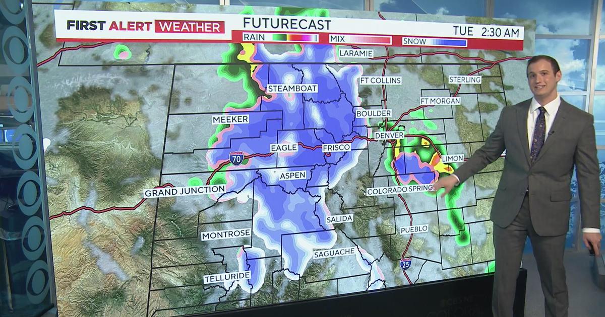
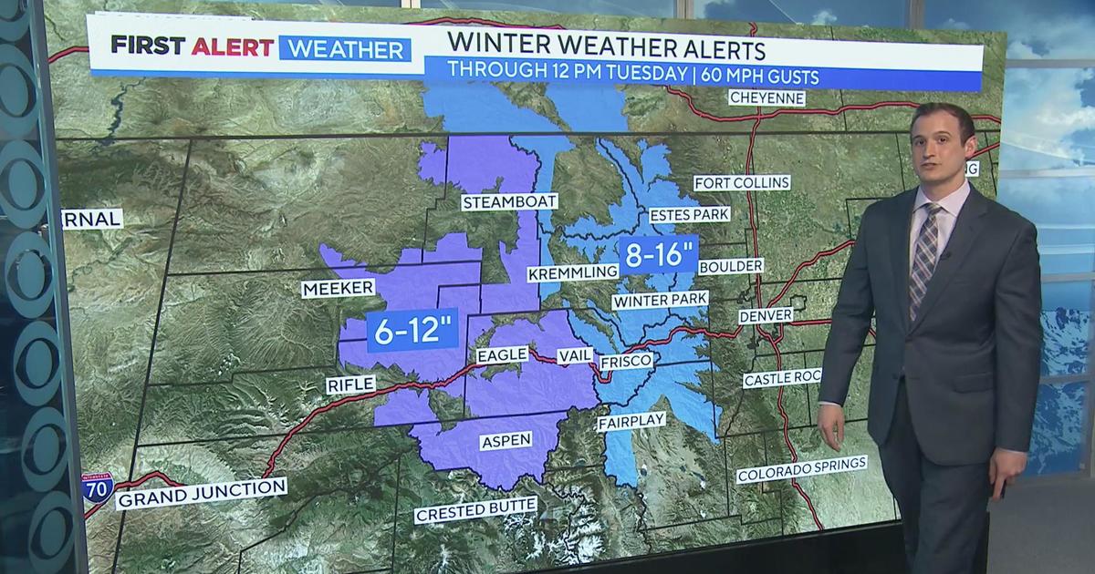
Sunday will be windy again in the mountains and foothills although not quite as strong as Saturday. Add into that another batch of moisture pushing in from the northwest. This will produce snow in the mountains again overnight Saturday into Sunday. Some mountain areas may see 3 to 6 inches of snow. With a few of the west-facing areas seeing closer to 6 to 8 inches. Denver and the eastern plains will see mostly clear skies on Sunday. With Denver's high warming to near 40.
The parting shot of snow on Friday was the trough sliding over the central Rockies. And although most of the Denver metro area missed out on the snow. Just north of the city from Thornton up into Fort Collins and the northern foothills got blasted with snow late in the day on Friday.
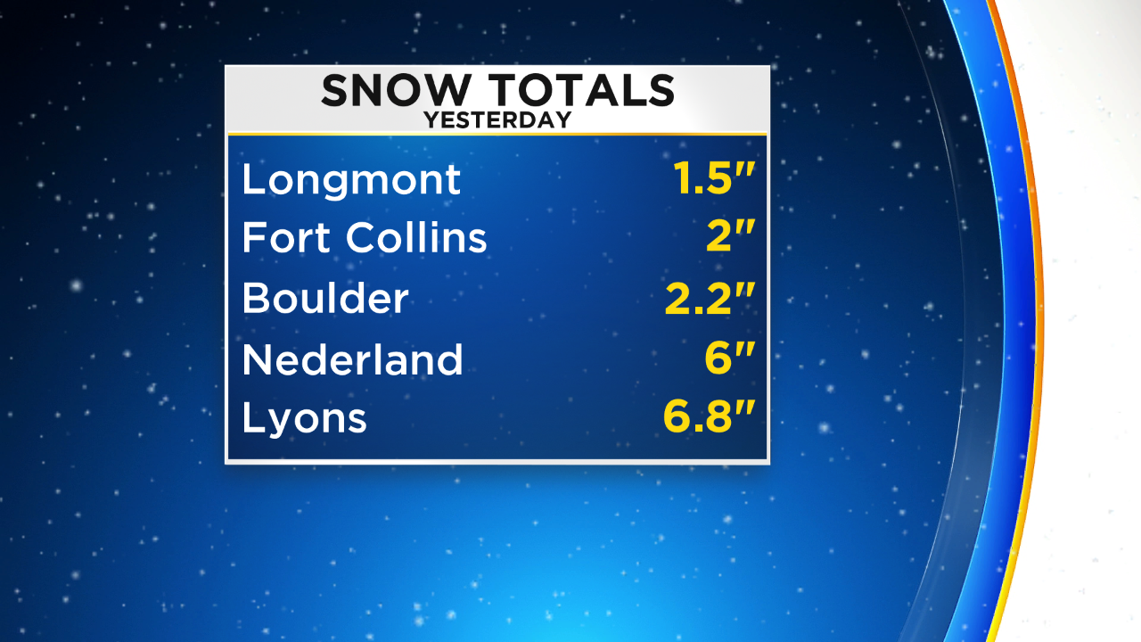
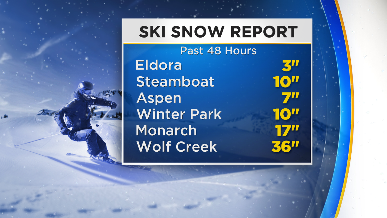
In the last two days many ski areas of our state also picked up some awesome fresh snow amounts!
With the slow warming trend taking over highs over the Mile High City and surrounding suburbs will be getting into the 40s by Monday and possibly upper 50s by the middle of the week ahead.


Meteorologist Dave Aguilera is a Colorado native and has been forecasting weather in the Rocky Mountain region for over 25 years! Connect with Dave on Facebook and on Twitter @DaveAgCBS.