Snow, Wind & Blizzard Conditions For Some Today
By Chris Spears
DENVER (CBS4) - A strong winter storm will transition from the mountains to the eastern plains today with the worst conditions expected to hit northeast Colorado.
Snow and wind will last into the evening as low pressure intensifies over western Kansas.
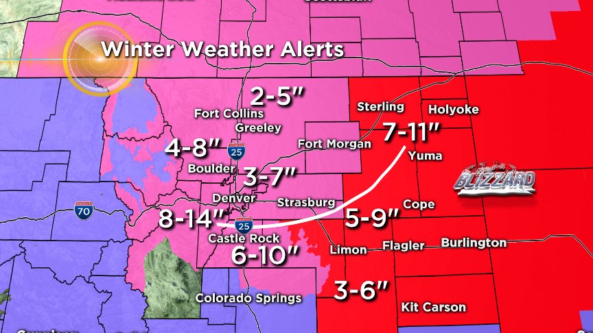
A blizzard warning is in effect for extreme northeast and east-central Colorado where snow totals could approach a foot in some places and winds up to 40 mph will create whiteout conditions.
PHOTO GALLERY: Pictures Of Colorado's January 2018 Snow Storm
The wind and snow will be lighter in north-central Colorado around Loveland, Greeley and Fort Collins and it will increase as you move south on I-25 into the southern suburbs of Denver.
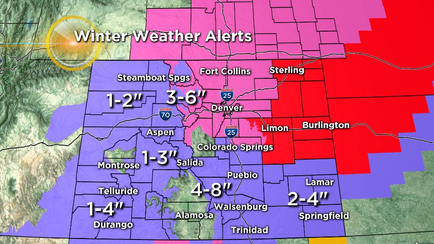
Lingering snow showers are expected in the mountains but totals will be less than four inches.
Skies will clear for Monday but there will be lingering wind on the plains.


Meteorologist Chris Spears travels weekly in the CBS4 Mobile Weather Lab reporting about Colorado's weather and climate. Check out his bio, connect with him on Facebook or follow him on Twitter @ChrisCBS4.