Countdown Until Our Polar Plunge ... 2 Days!
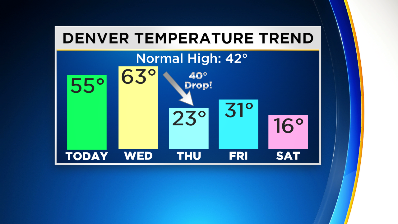
DENVER (CBS4) - Dry and relatively mild weather will continue across all of Colorado on Tuesday. High temperatures in the Denver, Boulder, and Fort Collins areas will be similar to Monday with lower to middle 50s.
Wednesday will bring even milder weather with highs in the lower 60s for the metro area. The day should start with a lot of clouds and then we'll see clearing during the afternoon. It's definitely the "warm before the storm".
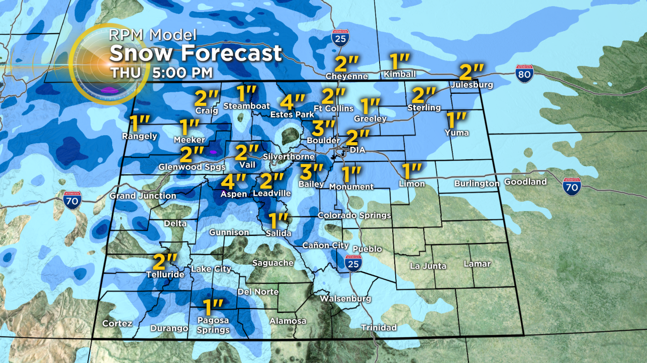
On Thursday morning an arctic cold front will pass over Denver and the Front Range bringing us the coldest air we've experienced since last February. Highs will struggle to reach the lower 20s before temperatures plummet into the single digits for the first time this season Thursday night into Friday morning.
Snow will also accompany the arctic air in many areas but accumulation will be minor. In the metro area, we expect no more than 3" of light, fluffy snow Thursday morning. The mountains could see up to 8" at a few lucky ski areas. Generally the mountains will see no more than 3-6".
Friday will be sunny but quite cold with temperatures staying below freezing. Then another surge of arctic air arrives on Saturday along with with another chance for snow. But similar to Thursday, any snow accumulation on Saturday should be minor. High temperatures will likely stay in the mid teens and Denver should drop to around -1° early Sunday morning.
Sunday and Monday will be dry for Christmas but it we'll stay in the deep freeze through at least Tuesday.


Ashton Altieri is a Certified Broadcast Meteorologist. Watch him on the CBS4 Morning News weekdays from 4:30 a.m. to 7 a.m. Connect with Ashton on Facebook and on Twitter @AshtonCBS4.