Freezing Drizzle Possible Tonight, Morning Travel Could Be Slick
By Chris Spears
DENVER (CBS4) - Get ready for a little bit of everything from Nature Nature tonight along portions of the Front Range.
And while totals will be light overall there could be some pretty big impacts to travel by Tuesday morning.
Foothills, Fort Collins, Larimer & Weld Counties
After sunset on Monday light snow is expected to develop in elevations above 7,000 feet with the potential for several inches to accumulate in the foothills of Larimer County.
Up to four inches of snow is possible in and around Fort Collins and northwest Weld County.
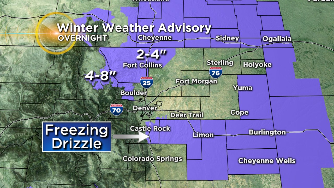
Denver Metro Area
The forecast is much trickier around metro Denver and points to the south and east where everything from mist and drizzle to fog and flurries will be possible.
That's because an atmospheric inversion is in place, meaning there's a layer of warmer air trapped just above the ground. Initially, that warmer air will melt anything "frozen" that falls from the clouds.
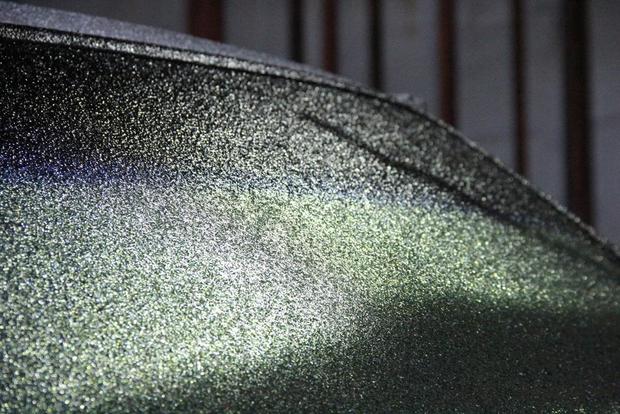
But because temperatures at the ground will cool to freezing overnight, frozen precipitation that melted on the way down to the ground, will refreeze on contact with surfaces on the ground (hence the term freezing drizzle).
This scenario could potentially create slick travel for the Tuesday morning commute.
As colder air pours in from Wyoming eventually the inversion should go away which will allow precipitation to both fall from the cloud and arrive at the ground as snow.
Meteorologist Chris Spears travels weekly in the CBS4 Mobile Weather Lab reporting about Colorado's weather and climate. Check out his bio, connect with him on Facebook or follow him on Twitter @ChrisCBS4.