Historic Snow Possible In Parts Of Colorado
DENVER (CBS4) - Our warm, spring weather will come to a very abrupt halt on Thursday as a powerful storm slams into the state. Snow and rain has already been falling in western Colorado, with rain possible along the Front Range overnight into Thursday.
For eastern Colorado and Denver, we'll see rain for most of Thursday with that turning over into snow potentially on late Thursday into Friday. We have a Winter Storm Watch for the Denver area, with the most snow expected mainly west of C-470 on the west side of town as well as along the Palmer Divide in Douglas and Elbert Counties. Here in Denver, we may see 2-6 inches of snow, but it will be very heavy, wet snow.

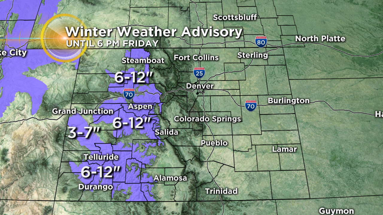
Mountain areas west of Vail Pass are under a Winter Weather Advisory through 6:00 pm Friday for 6-12 inches of snow. This includes the I-70 corridor in Eagle County and all points south that above 9,000 feet including the Aspen and Crested Butte areas as well as Telluride and San Juan Mountains. If you're planning on traveling through the high country, conditions could be pretty tough at times.
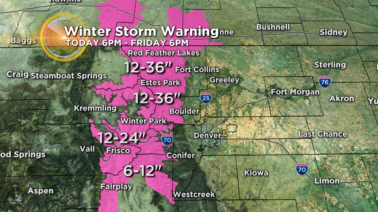
The mountains farther east including Summit County and Winter Park area are under a Winter Storm Warning through 6 p.m. Friday for 12-24 inches of heavy, wet snow. Some areas in Boulder and Larimer counties could see up to three feet of snow! It could be historic snow for locations like Estes Park, Nederland, Ward, Coal Creek Canyon, Red Feather Lakes and surrounding areas which it's extremely unusual to experience so much snow so late in the snow season.


Watch meteorologist Lauren Whitney on CBS4 News on weekday evenings at 5, 6, 6:30 and 10 p.m. Check out her bio, connect with her on Facebook or follow her on Twitter @LaurenCBS4.