Snow Outlook Grim For First Half Of November
By Chris Spears
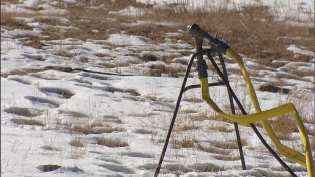
DENVER (CBS4) - An abnormally warm October has a few Colorado ski resorts pushing opening dates back and hoping for a change in the weather.
But the chances for a major storm during the first half of November look grim as forecast models continue to indicate that a stubborn jet stream pattern will remain in place.
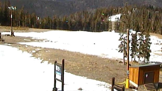
Over the past few weeks the main storm track has remained too far north and west to bring significant bouts of cold and wet weather to the Central Rockies.
Two other factors that are likely playing some type of role in the current pattern is the potential development of La Nina and a growing drought.
Last month government forecasters said there was a 70 percent chance that we'd see La Nina conditions develop by winter. Past events have taught us that Colorado can sometimes be warmer and drier than normal when a La Nina pattern is materializing.
Drought's role in our recent warm and dry weather involves the water cycle, where water evaporates from the ground, condenses in the air to form clouds, and hopefully provides precipitation. But because it's been so dry for so long, as weak weather systems have come by in recent weeks, all we've seen is scattered rain and snow.
As it stands now the next few weeks look like more of the same with the potential for a few weak weather systems to pass by, but nothing widespread and organized with a direct connection to moisture from either the Pacific Ocean or the Gulf of Mexico.
Meteorologist Chris Spears writes about stories related to weather and climate in Colorado. Check out his bio, connect with him on Facebook or follow him on Twitter @ChrisCBS4.