Atmospheric Inversion Keeps Denver, Eastern Plains 'Socked In'
By Chris Spears
DENVER (CBS4) - After several warm days eastern Colorado experienced a big cool down on Wednesday thanks to a strong cold front that moved across the region.
Behind it an area of high pressure over Nebraska kept a cool and moist flow of air traveling into the state.
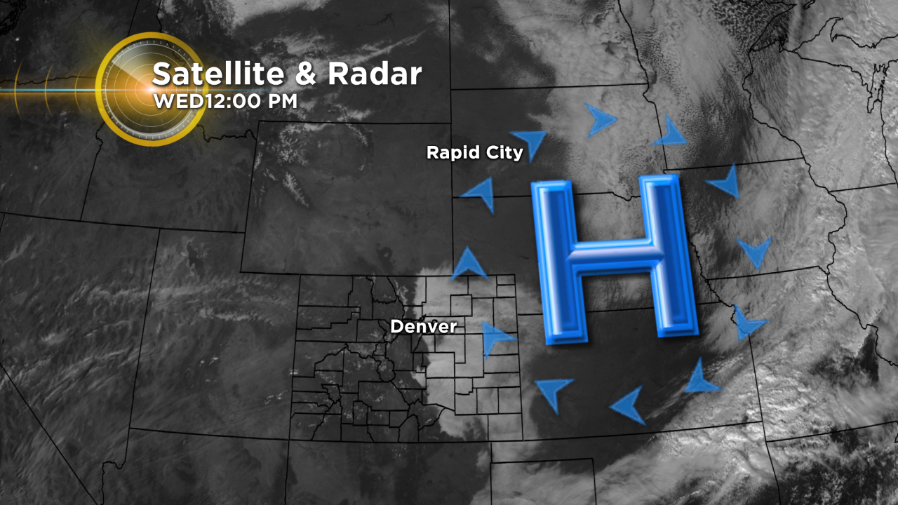
But the colder air got stuck over the lower elevations east of Colorado's Front Range due to a strong inversion in the atmosphere.
BEHIND THE SCENES EXCLUSIVE: Meteorologist Chris Spears stands on the edge of the inversion
Typically as you leave the ground and go up we expect temperatures to decrease with height. But on Wednesday, once you reached elevations of roughly 8,000 feet, the air began to warm.
The warming lasted for a few thousand feet before the atmosphere began to cool higher up.
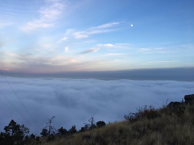
This 'trapped' layer of warm air, called an inversion, acts like a lid. If you're below the lid, you're stuck in the low clouds, fog and cooler air.
Above the inversion it's sunny, warmer and mostly clear.
Inversions are common during the early morning hours but they typically erode by mid-morning as the air mixes due to solar heating, a process called convection.
But the inversion on Wednesday was so strong that daytime heating wasn't enough to mix the atmosphere and scour out the low clouds.
The result was that almost everyone along and east of the foothills stayed socked in for most of the day.
Meteorologist Chris Spears writes about stories related to weather and climate in Colorado. Check out his bio, connect with him on Facebook or follow him on Twitter @ChrisCBS4.