Another Round Of Severe Weather
Severe weather is back in the forecast. As of this post, storms are strengthening in the Boulder County foothills and may move into central Denver shortly. Large hail, very fast winds, lightning, and heavy rain will all be possible.
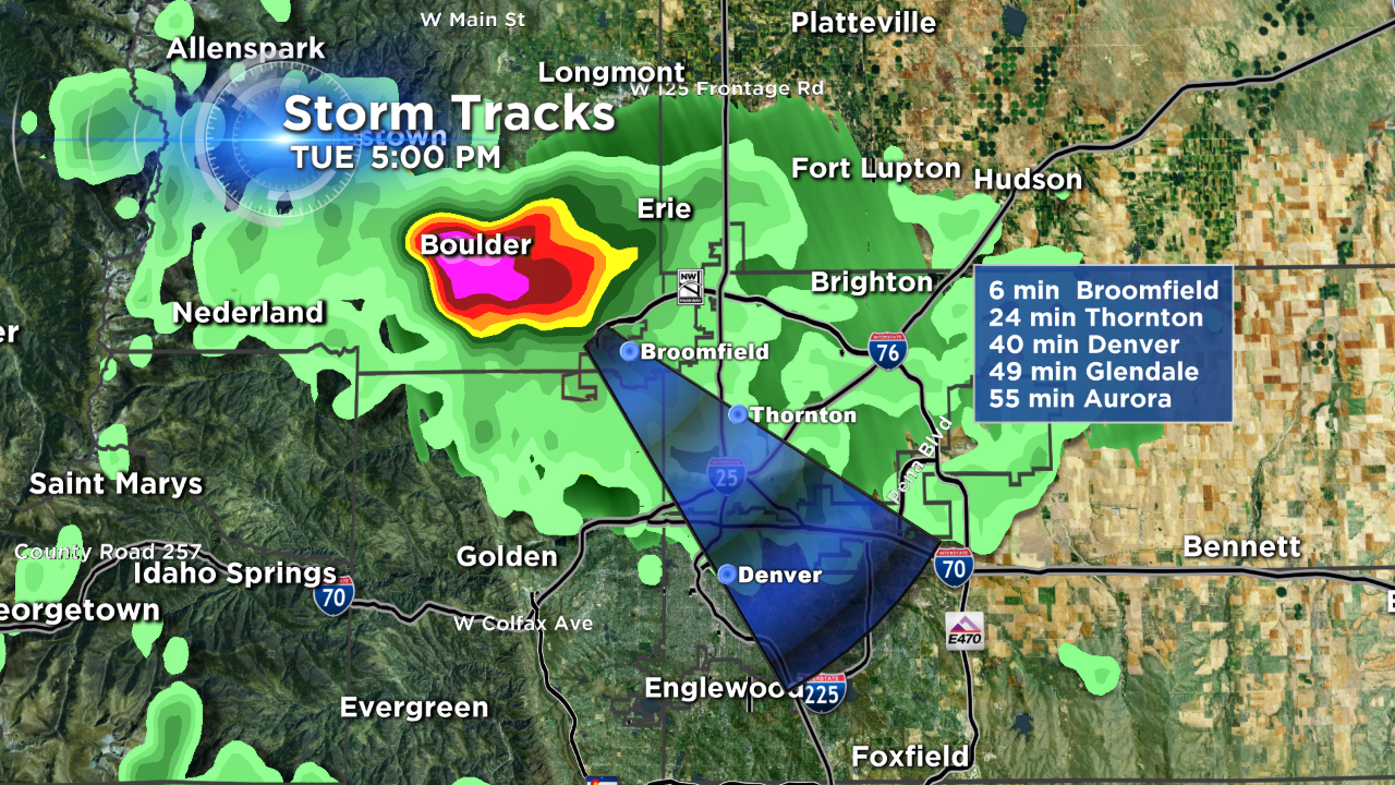
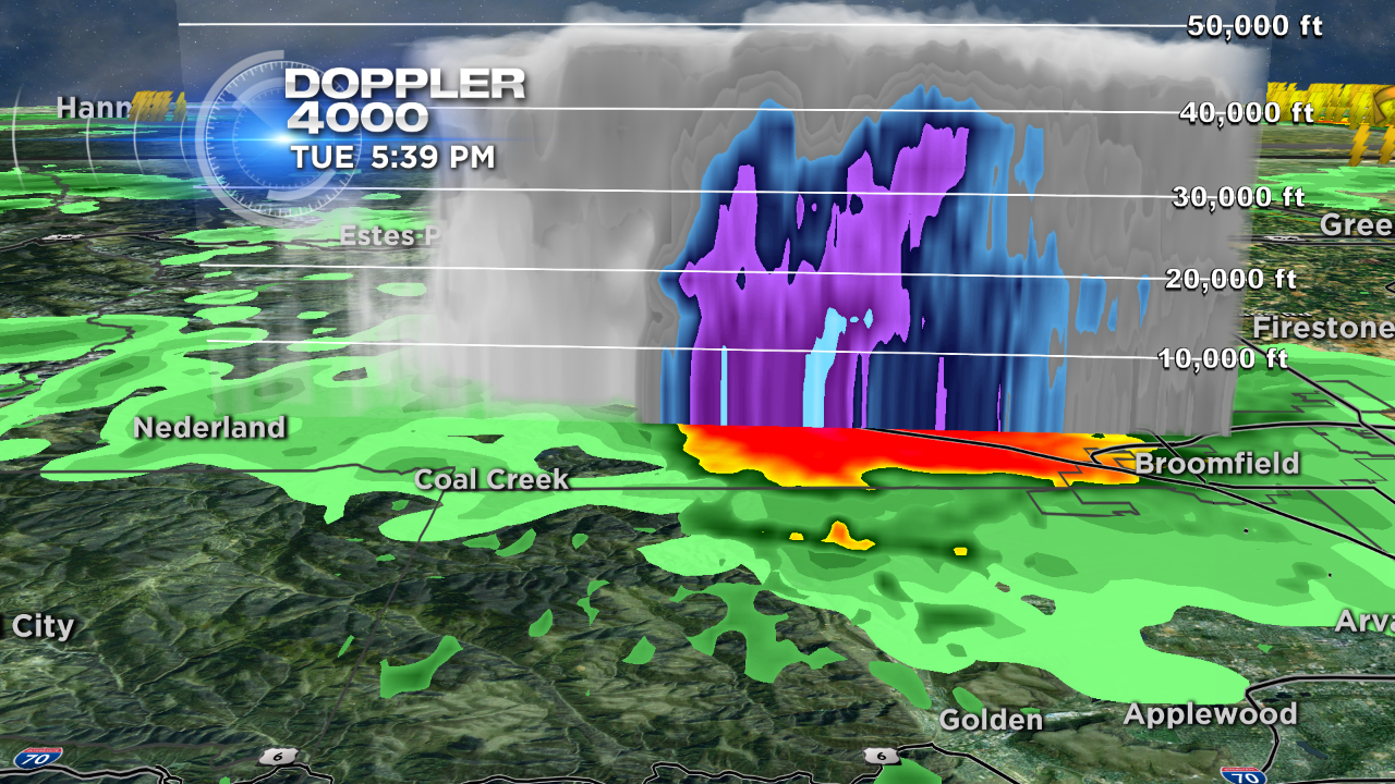
The current storm appears to have a very well defined updraft with hail currently falling in the city of Boulder. Radar is estimating the cloud tops at around 40,000 feet.
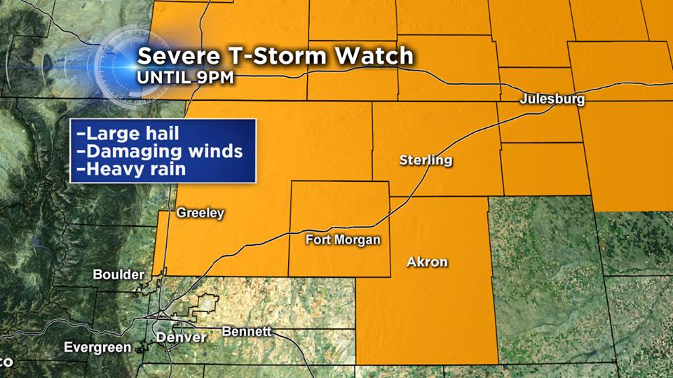
A Severe Thunderstorm Watch is posted for parts of the northeastern plains until 9 p.m. tonight. This will likely be the areas that see the largest storms. Many of the same counties that were hit with large hail Monday could have another round Tuesday night.
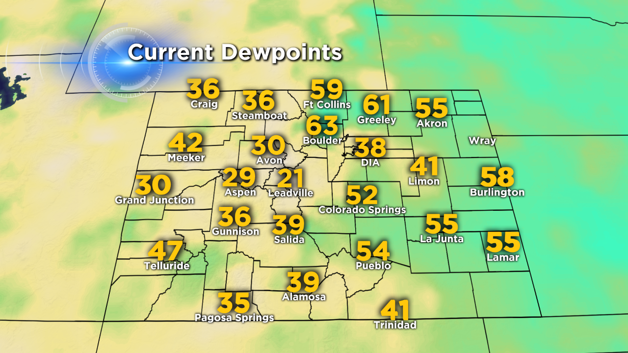
Humid and unstable air resides over the I-76 corridor near Sterling and Julesburg. Storms in southeastern Wyoming could intensify as they move into this airmass.
Unlike most severe weather setups, the upper level winds are moving around a high pressure system — rather than a low pressure system. These are moving fairly fast from a northwesterly direction, while the surface winds are coming in from the southeast. The difference in wind direction and velocity is creating enough shear to support highly organized supercells.
Justin McHeffey provides nightly reports from the Mobile Weather Lab. He travels Colorado in search of Mother Nature's most powerful and beautiful conditions. Like his Facebook page Meteorologist Justin McHeffey and follow him on Twitter @WeatherMcHeffey.