Weekend Snow Storm Enhanced By Omega Block
DENVER (CBS4) - Get ready for a SUPER SOAKER storm system heading our way for the weekend. We are watching an extremely slow-moving storm system that will bring severe thunderstorms, heavy rain and heavy, wet snow over most of the state. The area that will be hardest hit this weekend will be the foothills and mountains directly west of Denver, areas that could see 2 to 4 feet of snow!
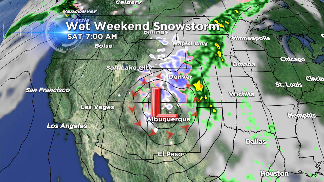
We will see the upper level jet stream help steer this powerful, moisture-packed, low-pressure area from the Pacific Northwest down across the central Rockies for the weekend. This storm will produce a prolonged period of rain and snow over the area, allowing cold Canadian air to push southward over the state, and spinning up copious amounts of moisture from the Pacific and the Gulf coast.
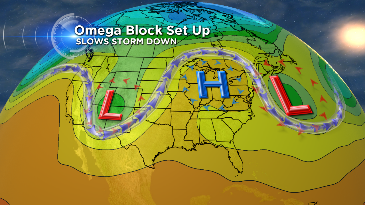
This storm system is being slowed down by a strong high pressure ridge over the mid-west and a strong low pressure system just off the east coast. In the forecasting world, this is known as an "Omega Block." The jet stream winds around the low, above the high, and around the other low, forming a pattern that looks like the Greek letter Omega.
This pattern will keep the low spinning over southern Colorado through Monday. So once it starts snowing overnight Friday it may not end until sometime on Monday for Denver and the eastern plains.
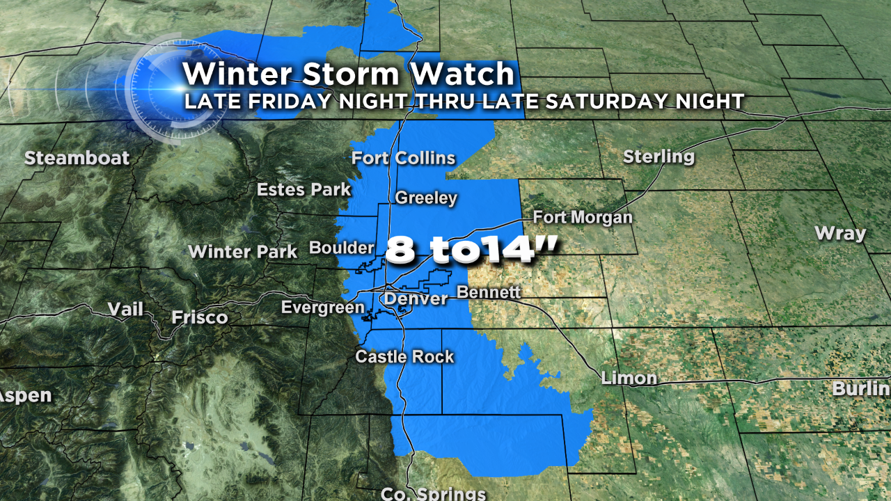
There is a Winter Storm Watch in place for all of the Denver metro area and surrounding suburbs late Friday through late Saturday.
We could see 8 to 14 inches of snow below 6,000 feet. This snow is going to be loaded with moisture making it very heavy and dense. So initially lots of it will melt, then compact down. Therefore, measured amounts will vary greatly depending upon the amount of melting and compaction. For example, you may receive a total of 14 inches by the end of the weekend, but only have half of that on the ground at any one time.
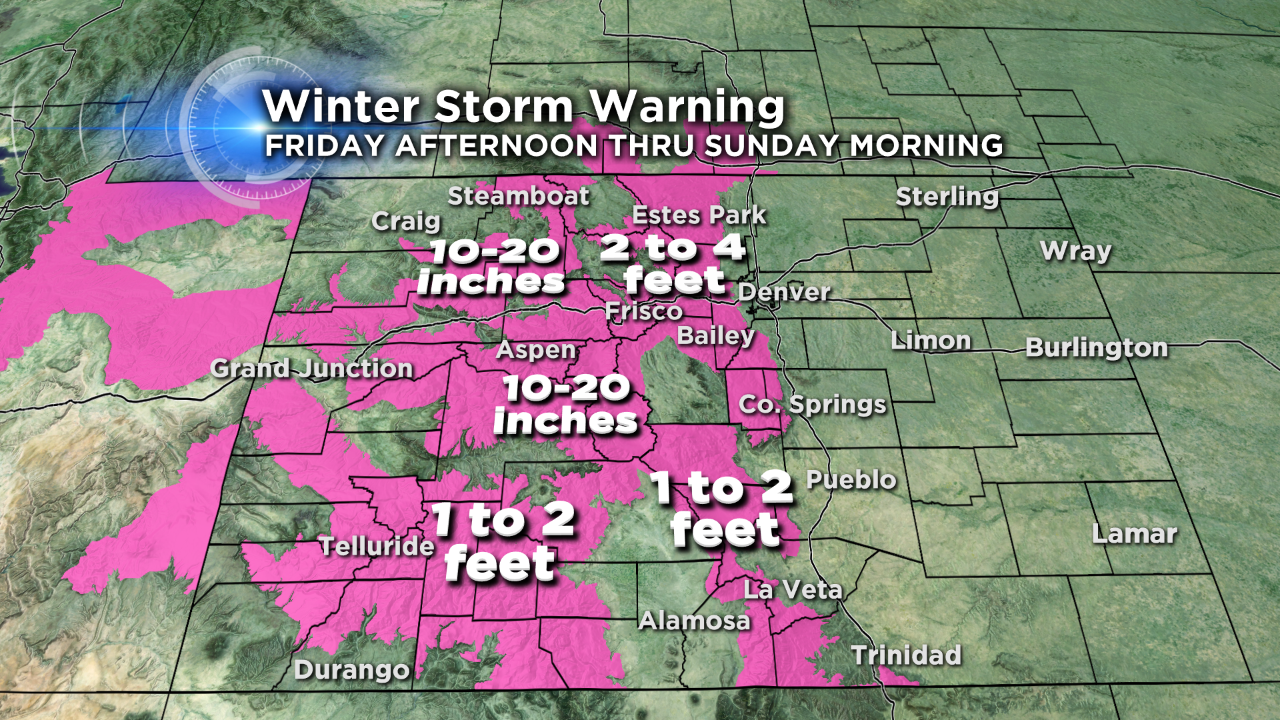
There is a Winter Storm Warning for all of the Colorado mountains and foothills beginning Friday afternoon through early Monday morning. The hardest hit area this weekend will most likely be the Foothills and mountains directly west of Denver. Snow amounts there may reach 2 to 4 FEET of snow by Monday.
This will be a dangerous storm to drive in and will be a branch-breaker for trees across areas of the Front Range and adjacent plains.