Warmer Temperatures Means Thinning, Dangerous Metro Ice
DENVER (CBS4) - It's hard to believe that Denver spent two February days in a row in the 60s. On Wednesday we hit a high of 66 degrees, Thursday we came up with 64 -- 20 degrees above average for this time of year. The weather definitely doesn't match the calendar, so it's easy to get caught off guard. Although it's the middle of winter, the ice on city lakes and ponds has become paper thin.
West Metro Fire advises safety around bodies of water. As you move away from the shoreline the ice tends to become thinner because it takes longer for the water to freeze. Even though it may appear safe to walk on a thicker layer of ice near shore, the ice tapers and becomes weaker in the center of the lake. The longer we go with above normal temperatures, the more prevalent this danger becomes.
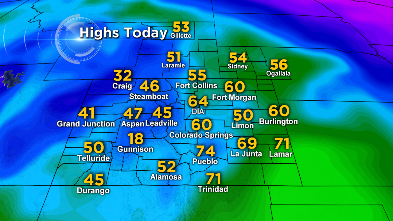
The westerly winds are producing these mild conditions east of the mountains. When the air travels over the Continental Divide, it lowers in altitude down the mountain slopes. This downslope, or, Chinook effect is responsible for the balmy string of weather for the next several days. Hard to even notice it's happening in places like Gunnison, though. It was only 18 degrees for a high on Thursday, the low was 15 below zero! Ice thickness doesn't appear to be a problem in that part of the state.
Justin McHeffey provides nightly reports from the Mobile Weather Lab. He travels Colorado in search of Mother Nature's most powerful and beautiful conditions. Like his Facebook page Meteorologist Justin McHeffey and follow him on Twitter @WeatherMcHeffey.