By Justin McHeffey
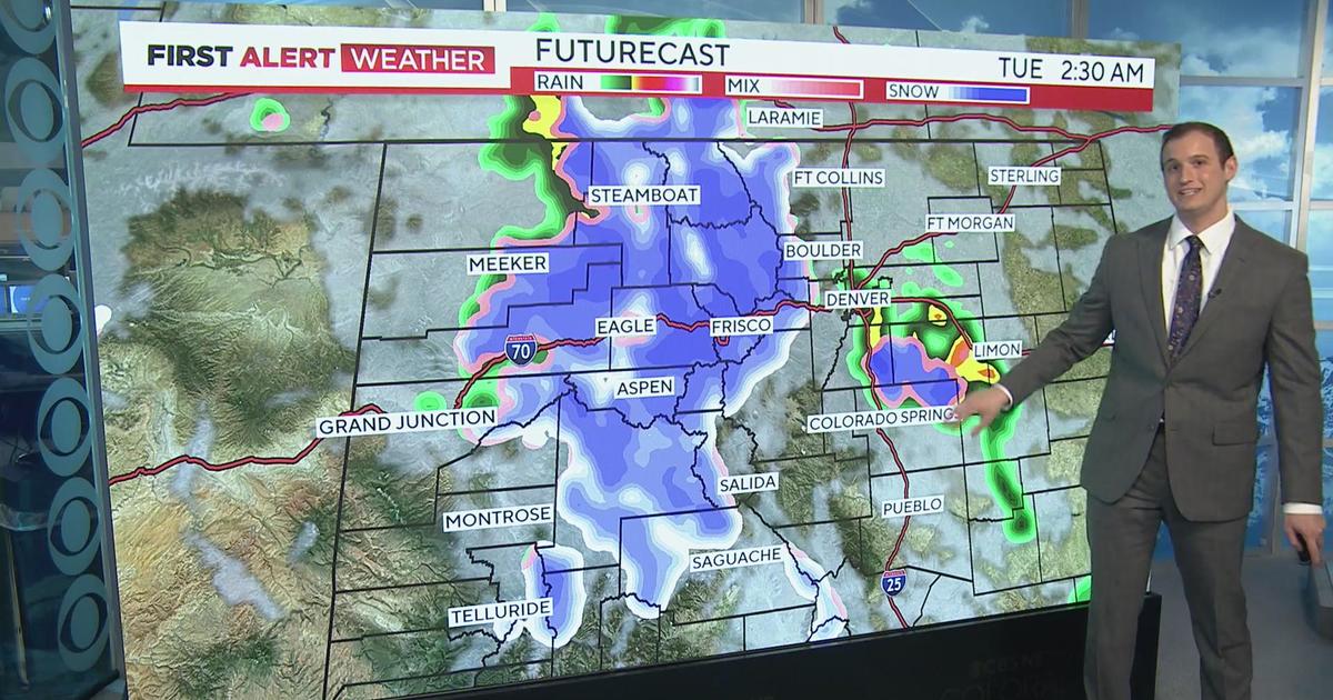
Monday's overnight storm arrives quietly, but may end up slamming parts of the metro area with nearly a foot of snow. The latest computer models bring 6-8" in central Denver, with 8-11" possible for the south metro area and the foothills. Looking specifically at the NAM (North American Mesoscale) model, there may be a prolonged period of heavy snow from about 2 a.m. until 8 a.m. Tuesday morning. That means the worst part of the storm will be here for the morning rush hour. It's Colorado and we're used to this, yes. However, if you can avoid a traffic snag by leaving a few minutes early it will pay off.
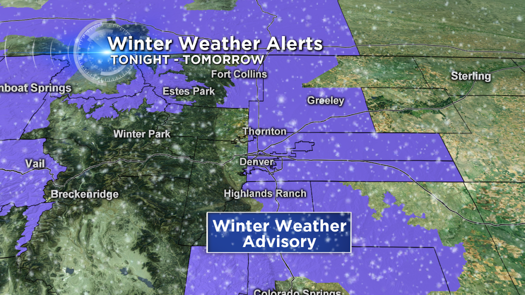
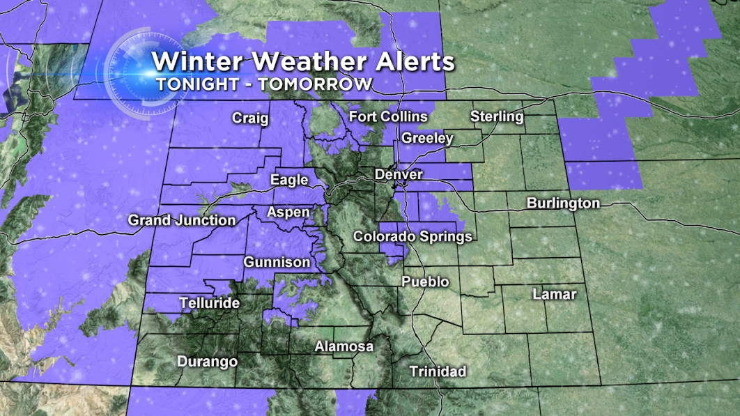
The Winter Weather Advisory was earlier posted for Denver, Arapahoe, Adams, Weld, eastern Douglas, western Elbert, and eastern Larimer Counties. 3-6" are the official National Weather Service predictions, but just after 9:30 p.m. they increased the expected amounts into the Winter Storm Warning category. So far this season, the most snow Denver has recorded in a 24-hour period was 2.8" on November 17.
The high country also has an Advisory for several inches of snow across the central and far western mountains of Colorado. This extends into Grand Junction, north to Steamboat Springs, and along the northern Front Range.
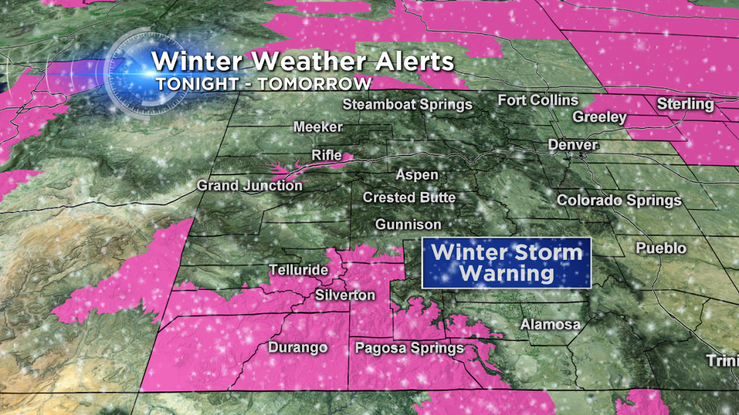
Winter Storm Warnings are active for the San Juan Mountains until 9 p.m. on Tuesday—this area could see 10-18" total. There's also a stretch of I-70 in the Warning area for the towns of Silt, Parachute, and Rifle. Up to 10" could fall here.
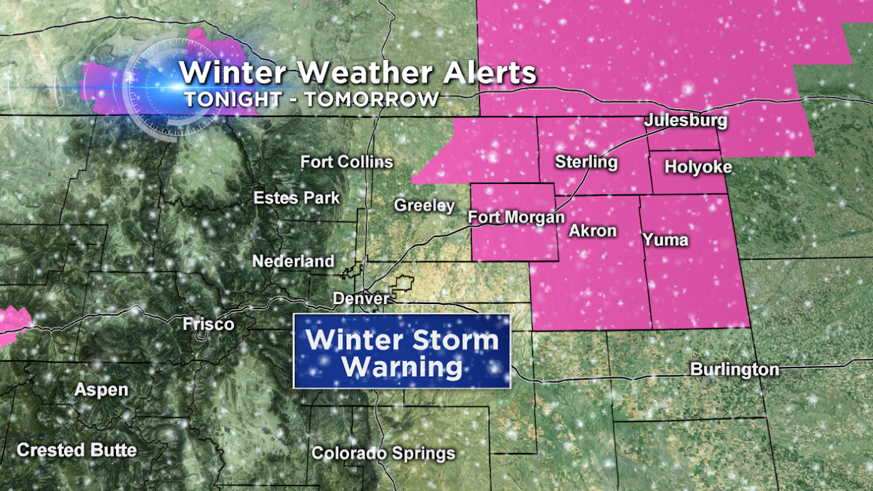
The northeastern corner of Colorado will also see wintry conditions with blowing snow. A Winter Storm Warning is posted for Yuma, Washington, eastern Weld, Morgan, Logan, Sedgwick, and Phillips Counties.
Why the sudden jump in projected snow totals for Denver? The upper level low may slow down as it crosses the state, that would give the snow a longer time to accumulate. Looking at the surface wind forecasts, the upslope (northeasterly winds) locks onto the Front Range for a solid 12 hours Monday night – Tuesday morning. In addition, the system strengthens as it crosses the Continental Divide Monday night. Meaning, once the center of circulation moves onto the plains, its central pressure lowers—this will allow more air to rise vertically and support widespread heavy snow. Lauren, Ed, and I will bring you the latest as it unfolds.
Justin McHeffey provides nightly reports from the Mobile Weather Lab. He travels Colorado in search of Mother Nature's most powerful and beautiful conditions. Like his Facebook page Meteorologist Justin McHeffey and follow him on Twitter @WeatherMcHeffey.