All Eyes On El Niño After Front Range Weather Station Records 30" Of Precip Since Jan. 1
DENVER (CBS4) - In a semi-arid state where drought can often be the weather headline we're grateful for a wet year.
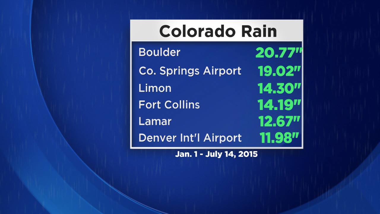
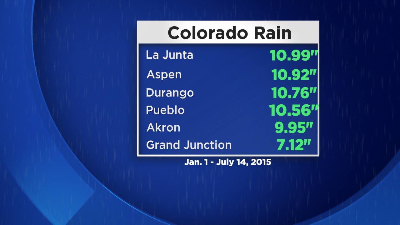
So far in 2015 many of the major reporting stations in Colorado have measured around a foot or more of precipitation, which includes both rain and melted snow.
But with a strengthening El Niño expected for the upcoming cold season its almost certain that more rain and snow will fall. That has some weather observers wondering if it will be a record year.
It has been particularly wet along the Front Range and on the adjacent plains.
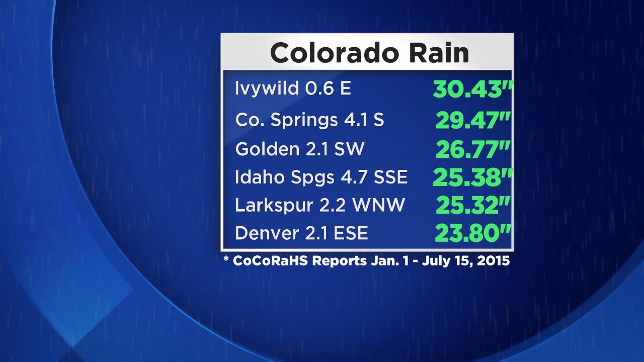
One of the wettest areas has been El Paso County where many CoCoRaHS rain gauges have measured anywhere from 25 to 30 inches of moisture since the beginning of January.
The biggest total comes from the southwest side of Colorado Springs where an observer has measured 30.43" of precipitation.
Check out CoCoRaHS totals around your county by clicking here.
RELATED READ: Denver Weather History Shows Wet El Niño Summers Can Bring Record Snowy Winters
El Niño is an abnormal warming of surface waters in the Eastern Pacific Ocean which can have an impact on global weather patterns during a moderate to strong episode.
In the United States this typically means the storm track stays further south than normal, keeping the southern half of the country unsettled, especially during the fall and winter.
In Colorado El Niño can mean big snow for portions of the southwest and central mountains as well as the Front Range.
The latest forecast issued by NOAA calls for a greater than 90% chance for El Niño to continue through the fall and winter season.