Overnight Snow Band Leaves Nearly A Foot In Westminster
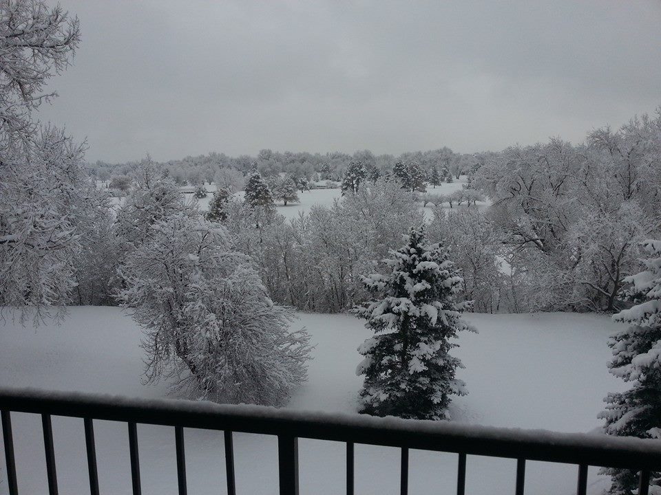
DENVER (CBS4) - Snow showers dropped anywhere from a half-inch to two inches of snow overnight along the Front Range, but it was a different story on the north side of town.
A very narrow but intense band of snow developed from just outside of Boulder to northwest Aurora leaving a quick 6 to 10 inches of snow behind.
The snow was heavy and wet and was melting quickly on the streets due to the warm pavement.
More bands of snow are expected through the early afternoon hours on Saturday along the Front Range.
Should you get under one of these snow bands don't be surprised if you receive a few inches of snow in a short period of time.
 (credit: CBS)
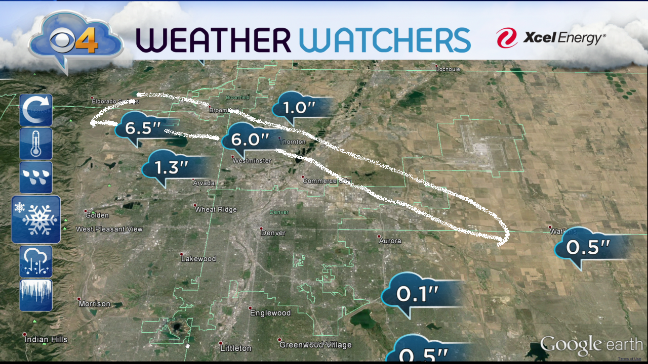
Two of our CBS4 Weather Watchers were under this morning's snow band and two others were on either side.
It's a great example of how variable our weather can be over such a short distance.
RELATED: BECOME A CBS4 WEATHER WATCHER
Don't let these bands of snow or even a brief period of sunshine Saturday fool you, the main event is yet to come.
A cold front will move through eastern Colorado by this evening and it will bring much colder weather and widespread snow.
The snow could be locally heavy at times tonight and gusty winds behind the front may create some areas of blowing and drifting snow.
MORE: DETAILED FORECAST
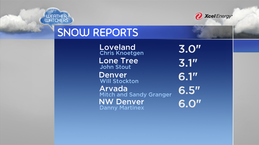
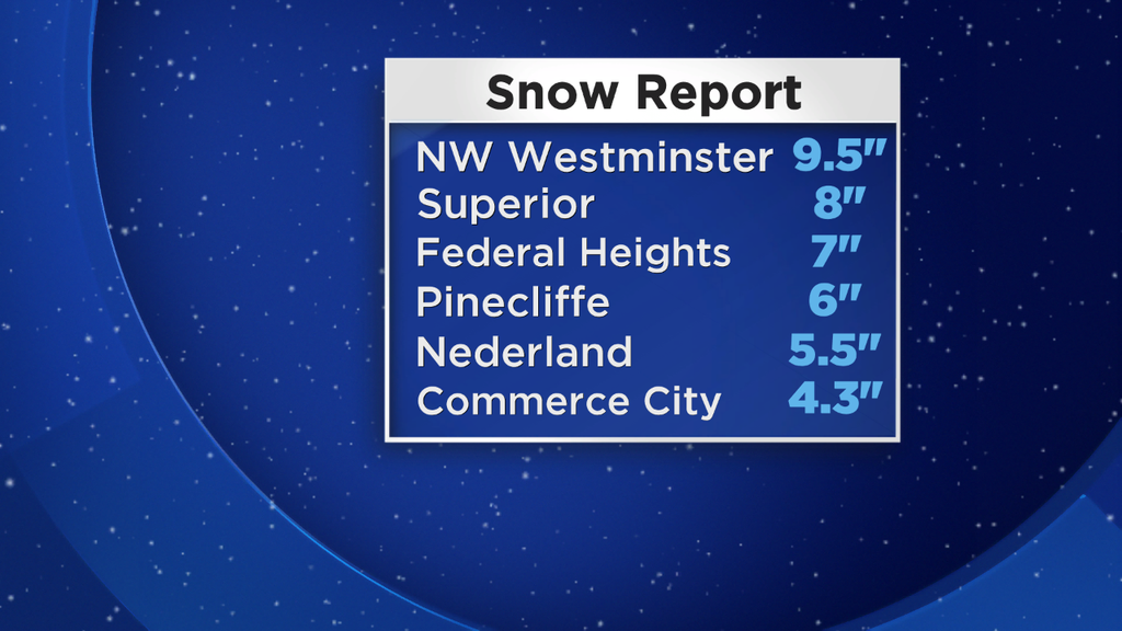
Here are some snow totals reported by CBS4 Weather Watchers and the National Weather Service as of 9 a.m. Saturday.
 (credit: CBS)
 (credit: CBS)
Meteorologist Chris Spears writes about stories related to weather and climate in Colorado. Check out his bio or follow him on Twitter @ChrisCBS4.