Colorado Weather Center Monitors Weekend Snowstorm, Could Drop Over A Foot In Some Areas
DENVER (CBS4) - With just a few days to go before the weekend, I've noticed a buzz here in the CBS4 newsroom about the potential for a heavy weekend snowstorm.
Here's a detailed discussion of what we're watching from the Colorado Weather Center.
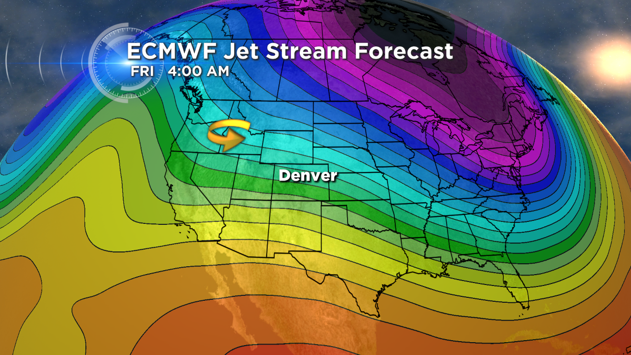
As we move into Friday, a storm system is forecast to take shape over the northern Rockies, indicated by the yellow arrow on the map below.
 (credit: CBS)
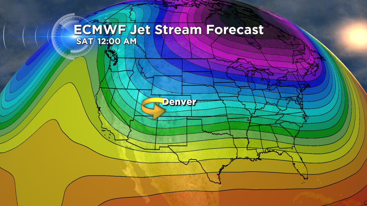
That storm is expected to drop south through the day on Friday, ending up somewhere over Nevada or Utah by midnight Saturday.
 (credit: CBS)
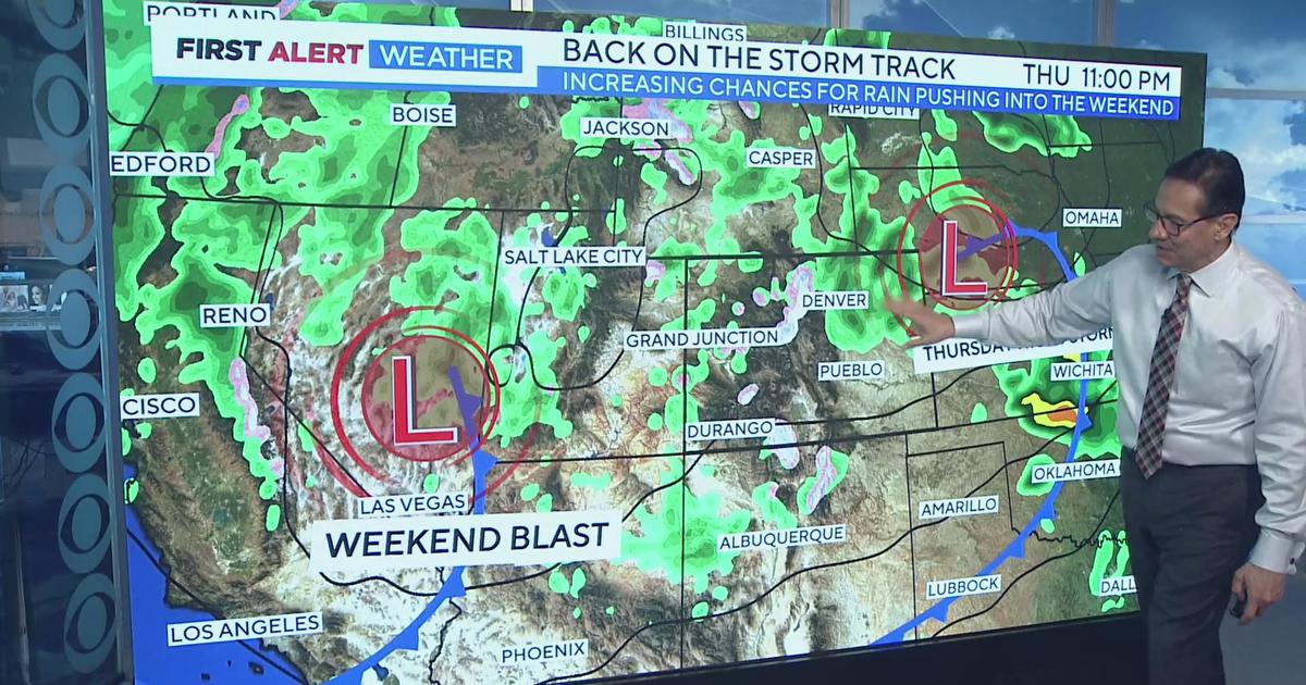
As it moves into a position west of Colorado, it will bring a gradual increase in cloud cover throughout the day with rain and snow showers quickly developing over the course of Friday night.
Current forecast models show the storm system lingering over the central Rockies for the entire weekend, which would keep Colorado cool and wet.
There are a number of factors that will play into what actually happens, including where the storm system ends up as it drops south on Friday.
Small shifts in its position could mean a much different forecast as far as snow totals, thanks in part to that amazing 14,000 foot fall of granite that sits across the middle of our state.
Having said that, current thinking is that we will see favorable conditions for widespread snow starting late Friday and potentially lasting into early Monday.
During that time, it looks like there might be two distinct periods of moderate to heavy snow, with lighter snow in between.
One would be early Saturday and the other late Saturday into Sunday.
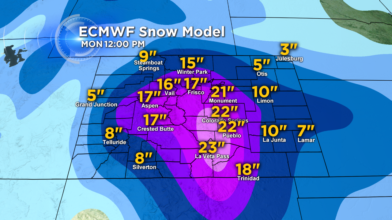
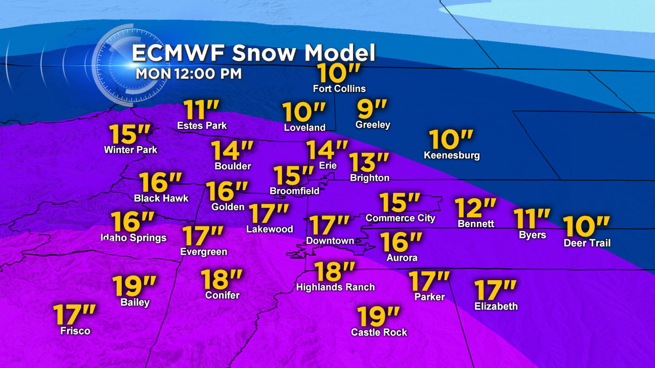
The following is what the European model is showing for potential snow across Colorado and in the Denver metro area.
It happens to be one of the more aggressive models in terms of possible snowfall.
Accumulations shown are from 10 p.m. Friday through 12 p.m. on Monday.
 (credit: CBS)
 (credit: CBS)
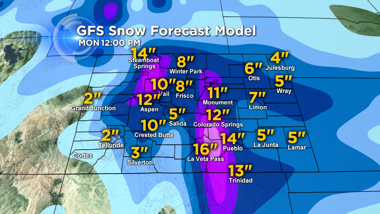
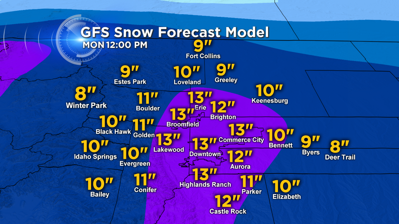
The next two graphs are from the Global Forecast System model and show potential snowfall across Colorado and in the Denver metro area.
It also indicates the possibility of a rather large snow event this weekend, though not quite as heavy.
Accumulations shown are from 10 p.m. Friday through 12 p.m. on Monday.
 (credit: CBS)
 (credit: CBS)
It's important to stress one more time that this storm is highly subject to change depending on how it ultimately evolves on Friday.
But with so much interest in weekend planning, we wanted to give you a snapshot of how things are looking at this time.
Stay with CBSDenver.com, CBS4 and the Colorado Weather Center for more updates as we continue to monitor the extended forecast.
Meteorologist Chris Spears writes about stories related to weather and climate in Colorado. Check out his bio or follow him on Twitter @ChrisCBS4.